

Understanding Contours

Land survey topography is an essential part of planning and developing land. It involves mapping the features of a landscape to help make informed decisions about construction, property boundaries, and land use. If you’re curious about this, here’s what you need to know in a nutshell:
- Objective: Identifies and maps topographical features
- Uses: Planning, constructing, and managing land
- Methods: Includes field measurements and aerial imagery
Land survey topography provides a detailed view of the earth’s surface contours and features. Understanding these elements is crucial for anyone involved in land development, from architects to builders, and even homeowners. This form of surveying ensures that you can plan effectively, meet legal requirements, and minimize risks associated with natural land features.
It’s vital particularly in areas with complex geographical features, where the accuracy of a topographical survey can prevent costly construction errors and legal disputes over boundaries. Such precision is not just about capturing the current state of the land but also involves predicting how changes to the environment—like construction or natural erosion—might affect the area in the future.
What is Land Survey Topography?
Land survey topography involves the detailed recording and mapping of the physical features of a specific area. This includes both natural elements like hills and rivers, and man-made features such as roads and buildings. The purpose of this type of survey is to create a precise model of the terrain, which can be used in planning, construction, and environmental management. The history of land survey topography dates back to ancient civilizations, where early surveyors used simple tools to map their surroundings. Today, the field combines traditional methods with advanced technology to achieve greater accuracy and detail.
Types of Topographical Surveys
Topographical surveys can be categorized into three main types:
- Land Surveys: These are the most common type of topographical surveys and focus on measuring terrestrial sites. They are essential for property boundary delineations, construction, and land development.
- Aerial Surveys: Utilizing aircraft or drones, these surveys capture data from above, providing a comprehensive view that’s invaluable for large-scale mapping, environmental monitoring, and urban planning.
- Hydrographic Surveys: These are conducted over bodies of water and are crucial for marine navigation, underwater construction, and environmental studies in aquatic environments.
Key Equipment Used in Topographical Surveys
The accuracy of a topographical survey depends heavily on the technology used. Here are some key pieces of equipment:
- Total Stations: These are a staple in land surveying, combining electronic distance measurement and angles to calculate precise positions.
- GPS (Global Positioning System): GPS units provide satellite-based positioning that is essential for area mapping and asset management, offering high accuracy even in remote locations.
- Drones: Increasingly popular in modern surveying, drones equipped with cameras and sensors can quickly cover large areas and inaccessible terrain, capturing detailed aerial photographs and data.
These tools have revolutionized the field of land survey topography, making surveys quicker, safer, and more accurate. As we continue to see advancements in technology, the capabilities and applications of topographical surveys are set to expand even further, enhancing our ability to plan and build with precision and care.
How Accurate is a Topographical Survey?
Accuracy in a topographical survey is paramount. The reliability of the data gathered during these surveys directly impacts the success of various projects, from large-scale construction to environmental management. But how do we achieve this high level of precision?
Achieving High Precision
Several factors influence the accuracy of a topographical survey:
- Equipment: The tools used in topographical surveys are crucial. Advanced equipment like robotic total stations, GPS GNSS RTK Rovers, and drones ensure high precision in capturing data. Each piece of equipment is suited for different types of terrain and project needs, which helps in collecting accurate data efficiently.
- Calibration: Regular calibration of survey equipment is essential. Calibration ensures that the instruments maintain their accuracy over time, despite the wear and tear from regular use. This process involves adjusting the instruments to meet standard specifications and can significantly enhance the accuracy of the survey results.
- Standards: Adhering to industry standards and guidelines is vital. These standards are set by authoritative bodies and ensure that the surveying process and results meet the required precision for various applications. Following these guidelines helps in maintaining consistency and reliability across different projects and survey teams.
- Techniques: The techniques employed by surveyors also play a crucial role in achieving high precision. For instance, setting up control stations at strategic points around the survey area helps in checking the accuracy of the measurements throughout the survey process. These techniques are refined over time and with the advent of new technologies.
- Technology: The integration of new technologies like laser scanning and drone photogrammetry has transformed the field of topographical surveying. These technologies allow for rapid data collection over large and difficult-to-access areas, providing highly detailed and accurate models of the terrain.
By focusing on these aspects — equipment, calibration, standards, techniques, and technology — surveyors can ensure that their topographical surveys are as accurate as possible. This precision is critical not just for the success of individual projects but also for the safety and sustainability of the developments that rely on these surveys.
As technology continues to advance, the accuracy and applications of topographical surveys will only increase, offering even more possibilities for industries ranging from construction to environmental conservation.
Applications of Land Survey Topography
Land survey topography plays a pivotal role in various fields, significantly impacting construction, agriculture, and environmental management. By providing detailed and precise information about the land’s physical characteristics, topographical surveys guide effective planning, design, and risk management in these sectors.
In Construction
Planning and Design:
In the realm of construction, land survey topography is indispensable. Before any ground is broken, a topographical survey can identify the best locations for buildings, ensuring they are placed optimally for structural integrity and aesthetic value. It helps architects and engineers design structures that seamlessly integrate with the natural landscape, minimizing earthwork costs and enhancing stability.
Risk Management:
Topographical surveys are crucial for identifying potential risks such as slope instabilities, flood zones, and problematic soil types. This information allows construction managers to implement preventive measures early in the project, reducing the likelihood of costly and dangerous issues arising during construction. For instance, knowing the slope of the land can prevent building in areas prone to landslides or excessive erosion.
In Environmental Studies
Flood Risk Assessment:
Topographical data is critical in assessing flood risks. By analyzing the contours and elevations of an area, environmental scientists can predict how water will flow and accumulate during heavy rains, helping to design effective flood mitigation strategies such as levees, drainage systems, and retention basins.
Ecosystem Mapping:
Topographical surveys provide essential data for mapping habitats and ecosystems, which is crucial for biodiversity conservation. This mapping helps in understanding the spatial distribution of various species and their habitats, guiding conservation efforts and land use planning to minimize human impact on these areas.
Conservation Efforts:
In conservation, the detailed data from topographical surveys enable the precise delineation of protected areas and help in monitoring changes in the landscape over time. This is vital for tracking the effectiveness of conservation measures and understanding the impact of human activities on natural landscapes.
In summary, land survey topography serves as a foundational tool in industries that shape our environment and living spaces. From ensuring safe and efficient construction projects to protecting natural ecosystems, the applications of topographical surveys are vast and vital. As we continue to develop and interact with our natural surroundings, the role of topographical surveys in planning and risk management remains indispensable, guiding us towards more sustainable and informed decision-making.
Moving forward, the integration of advanced technologies such as drones and 3D modeling continues to enhance the precision and applications of topographical surveys, promising even greater contributions to construction and environmental management.
Performing a Topographical Survey: Step-by-Step
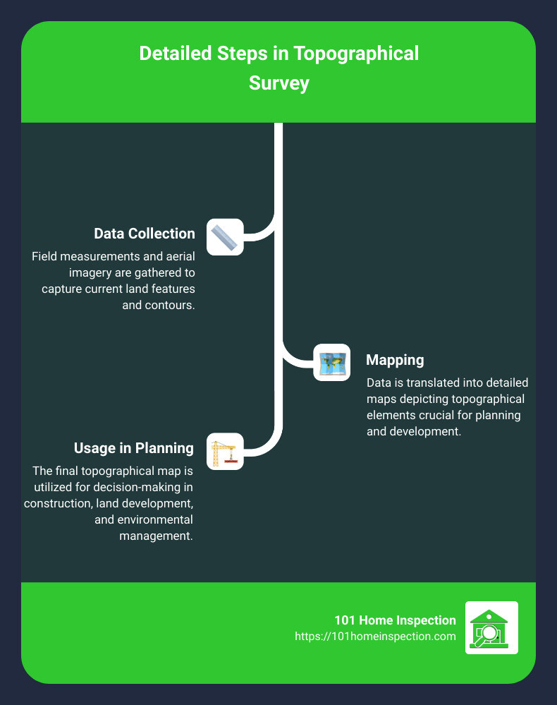
Performing a topographical survey involves a series of critical steps, each requiring careful attention to detail and the right tools. Here, we break down these steps from planning to data processing.
Planning
Planning is the first and crucial phase. During this stage, the scope and requirements of the survey are defined. Goals are set based on the end-use of the data, whether for construction, environmental management, or other purposes. This step ensures that all subsequent actions are aligned with the project’s objectives.
Fieldwork
Fieldwork is where the practical action happens. Surveyors visit the site equipped with the necessary tools to capture the land’s physical characteristics. This phase can vary significantly in duration depending on the project’s complexity and the terrain’s challenges.
Data Processing
After data collection, data processing begins. This step transforms raw field data into usable formats, such as maps and models. Advanced software tools play a significant role here, turning data points into comprehensive visual representations of the land.
Choosing the Right Survey Equipment
Selecting the right tools is essential for accurate data collection. Trimble systems, known for their reliability in GPS technology, are frequently used for their precision. UAV technology or drones are employed to access difficult terrains and gather large swathes of data quickly. Additionally, laser scanning provides detailed 3D models of surveyed areas, capturing minute details that are crucial for intricate projects.
Analyzing Survey Data
The final step involves analyzing the survey data which is where technology really comes to the forefront. CAD software helps in creating detailed 2D and 3D models. These models are essential for architects and engineers who rely on accurate designs to plan projects. GIS integration further enhances this process by allowing the incorporation of geographical data into the planning, which is vital for large-scale projects like urban planning and environmental conservation.
Through these steps, a topographical survey provides a detailed and accurate representation of the land, critical for various applications in construction, agriculture, and environmental management. The integration of advanced technologies such as UAVs and laser scanning continues to refine the accuracy and efficiency of these surveys, shaping the future of how we interact with and manage our physical environment.
Frequently Asked Questions about Land Survey Topography
What is the importance of topographical surveys in urban planning?
Land survey topography is crucial in urban planning because it helps city planners understand the physical characteristics of the land. This includes details like elevation changes, natural features, and man-made structures. With this information, planners can design efficient, safe, and sustainable urban environments. It aids in:
- Zoning and land use planning: Ensuring areas are used efficiently and safely, considering factors like flood risks and soil stability.
- Infrastructure development: Planning the placement of roads, utilities, and public transport systems to avoid costly adjustments later.
- Environmental conservation: Identifying and preserving natural habitats and green spaces within urban settings.
How can inaccuracies in topographical surveys impact construction projects?
Inaccuracies in land survey topography can lead to several issues in construction projects, ranging from minor inconveniences to major legal and safety problems. For example:
- Structural risks: Incorrect data can result in buildings being constructed in unsuitable locations, such as on unstable soil or too close to boundaries, which can lead to structural failures or legal disputes.
- Financial losses: Misjudgments based on inaccurate surveys can cause project delays, increased costs for rework, and potential fines if the construction violates regulatory requirements.
- Safety hazards: Incorrect elevation data can lead to inadequate drainage solutions, increasing the risk of flooding and associated hazards to the construction and future occupants.
What advancements in technology are shaping the future of topographical surveys?
The field of land survey topography is rapidly evolving, thanks to technological advancements that increase accuracy and reduce time and labor costs. Key innovations include:
- Drones and UAVs: These allow for rapid data collection over large and difficult-to-access areas, providing high-resolution imagery and real-time data.
- 3D Laser Scanning: Offers precise measurements of complex geometries and surfaces, creating detailed 3D models of the surveyed area.
- GPS and GNSS Systems: Provide real-time location data with high precision, crucial for large-scale mapping and remote locations.
These technologies not only enhance the accuracy and efficiency of topographical surveys but also make it possible to handle complex projects more effectively, ensuring that modern construction and urban planning can proceed with confidence in the data provided.
Conclusion
In this guide, we’ve explored the intricate world of land survey topography, detailing its importance, methods, and applications. From the careful planning stages through to the final analysis of data, topographical surveys are fundamental in shaping the landscapes and infrastructures of our environments.
Looking ahead, the future of topographical surveys is poised for transformative advancements. Integration of AI and machine learning will likely automate many aspects of data processing, increasing both speed and accuracy. Drone technology and 3D laser scanning are set to become more mainstream, providing even more detailed and frequent data capture. These innovations will ensure that topographical surveys continue to be a critical tool in urban planning, construction, and environmental management.
At 101 Home Inspection, we understand the critical role that accurate and comprehensive land survey data plays in ensuring the safety and success of any property development. We’re committed to incorporating the latest in survey technology and methodology to provide our clients with reliable and actionable insights.
Whether you are a developer, a construction manager, or a homeowner, understanding the lay of the land is paramount. With our expert services, you can navigate your projects with confidence, backed by precise topographical data that helps mitigate risks and optimize outcomes.
Stay ahead of the curve with us. Let 101 Home Inspection be your trusted partner in all your property inspection and survey needs, ensuring every decision you make is informed, strategic, and secure.